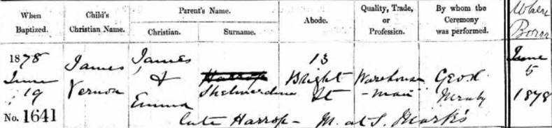
James Vernon Shelmerdine.1878 was born on the 5 Jan 1878 and baptised on the 19th June 1878 at St Michael church in Hulme to the parents of James Shelmerdine & Emma Harrop who are living at 13 Bright street, Hulme.
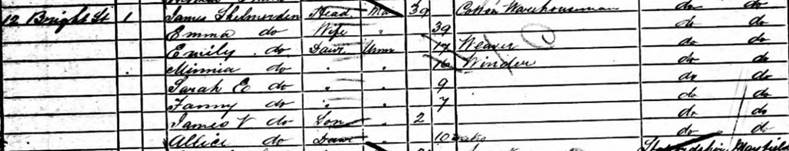
1881 census James Vernon is living with his parents at 12 Bright Street,
Hulme.
James Shelmerdine. age. 39. Head. Occ Cotton Warehouseman,
born Manchester.
Emma nee’ Harrop Shelmerdine. age 39. Wife. born Manchester.
Emily Shelmerdine. age 19. Daug. Occ Weaver. born Manchester.
Minnia Shelmerdine. age 16. Daug. Cotton Winder. born Manchester.
Sarah Shelmerdine. age 9. Daug. born Manchester.
Fanny Shelmerdine. age 7. Daug. born Manchester.
James V Shelmerdine. age 2. Son. born Manchester.
Alice Shelmerdine. age 10m. Daug. born Manchester.
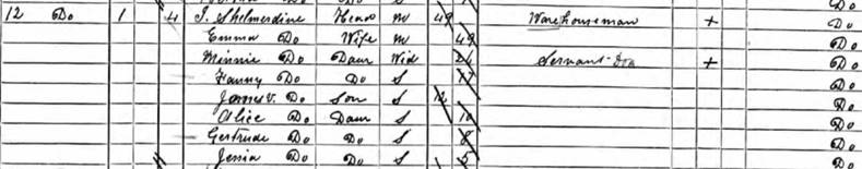
1891 census features James Vernon age 12 living with his parents at 12
Bright Street, Hulme.
James Shelmerdine.
age 49. Head
Emma
Shelmerdine. age 49. Wife
Minnie
Shelmerdine. age 26. Daug
Fanny
Shelmerdine. age 17. Daug
James V
Shelmerdine. age 12. Daug
Alice
Shelmerdine. age 10. Daugh
Gertrude
Shelmerdine. age 8. Daug
Jessia
Shelmerdine. age 5. Daug
1891
census entry
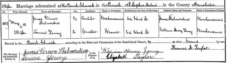
St Stephens Church C of E register extract.
Louisa’s parents lived on Lloyde Street in the same area. James and
Louisa first home address is given as Wood St, so they are all living
within streets of each other. Hulme was at the poor working-class suburb
specifically developed to house the lower working-class families when
developed in the 1840s but at the time the housing was of good quality
and a vast improvement of what they had to endure before
and the infrastructure was well develop with good transport links into central
Manchester
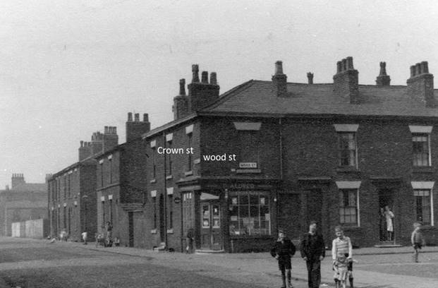
Junction of
Crown St. and Wood St. taken in 1954
James V Shelmerdine age 23.
Head. Occ Warehouseman. Born Manchester.
Louise Shelmerdine age 22. Wife.
Occ Weaver. Born Manchester.
James V Shelmerdine age 10m
Born Manchester.

1906 census extract
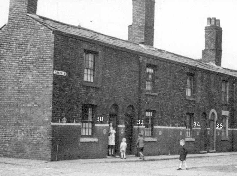
32 Green St. Hulme. 1954.
Green Street.
Having track the street
through historical maps it was built between 1836-1849 these being built
on virgin land at the time, so the first mass building of sanitary homes
to house the ever growing working class supplying cheap labour to the
ever growing manufacturing base . The house is a typical terrace 2
up and 2 down construction being one of the earliest type built around
1836-1849 with a back yard and outside toilet which was connected to an
enclosed sewer as it was written into local
law that such dwelling had to
have such at the time of their construction in the 1840’s. Its doubt
full that they had running water in the houses and at first, they did
have street
taps at the end of the street as water wasn't as well controlled source
as it was a private enterprise and the supply was erratic. it wasnt
until 1860 when further legislation came
into place, placing water supply under the local borough councils
obligations, such water supply was then being retro fitted to the properties
by the 1870s.
1911 Census: 13 Bright Street, Hulme,
Manchester. RDN: 464
Piece:23897
Louisa Shelmerdine. age 32. Widow/Head.
Occ Hemmer working at home.
Born Manchester.
James Vernon Shelmerdine. age 11. Son.
Occ at home.
Born Manchester.
Albert Shelmerdine. age 6. Occ at home.
Born Manchester.
Catherine Buchanan. Age 81.
Lodger/Widow.
Occ. None
Born Glasgow Scotland.

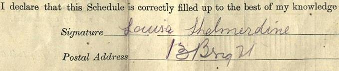
Extract from the 1911
census entry and Louisa’s signature as she may have filled it in herself.
Louisa Shelmerdine is described in the 1911
census as a Widow, her husband James Vernon died in the
Autumn of 1910 age 32.
His death certificate would have to be viewed to yield the cause of death. Louise is
working from home, working for an employer in the census. She was employed as a
Seamstress by trade and is described as a ‘Hemmer’ in the census. It was
common practice to work from home as a seamstress and you would be given
a sewing machine and supplied with the materials by a local employer on
piece work conditions so by the amount of units you had completed you
would be paid per piece. A daily collection service would have ensured Louise got all the materials
required and would have collected what work she had completed.
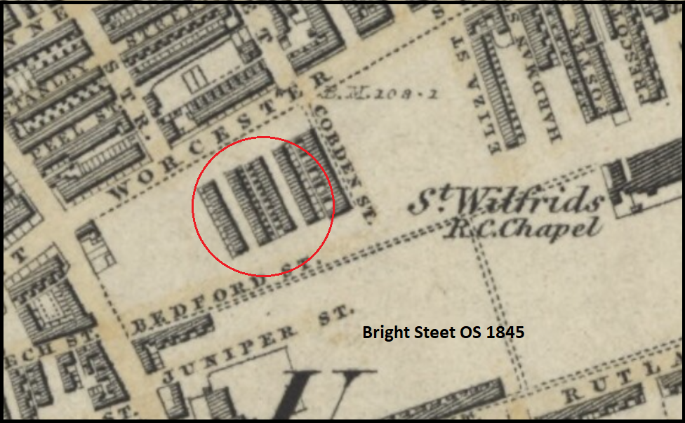
Bright Street. Again, having track the
street through historical maps it was built between 1836 to 1848 being a
2 up 2 down standard Terrance house of its time. We can assume therefore
there was a Parlor and kitchen down stairs and normally these rooms are
around 11 feet square(3.5metres) with stairs between them leading to two equal size
bedrooms. There would have been an outside toilet in the back yard which
you can see on the 1845 os map below.
This was a modern housing development of it time and such were a vast
improvement to what the working class had before, with a Gas supply, an
outside toilet connected to a buried sewage system and Towns water via a
tap at the end of the street, such was retro plumbed into the properties later on
around 1870 and around 1910 electricity came. As they second world war came
and went these properties were now decaying and posed a health risk,
famlies were over crowed with just two rooms and further legislation was
enforced to prevent and cattail over crowning
they would good for their era but had exceeded their life and in the
1950 through to the 1970's vast sways of such housing was being
demolished and replaced with multi-plex housing in the Hulme area this
too was quickly condemned as inferior in the 1980' and that too was
replaced with a more tradition housing stock.
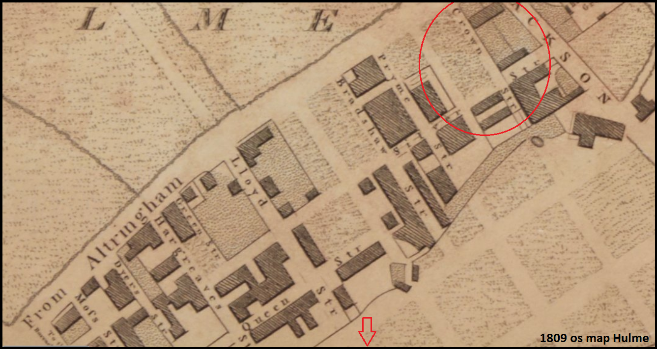
In the 1809 os map the area is clearly being laid out on a grid section
development pattern.
There isn’t a picture of the street in the Manchester Photo
archives but adjacent streets are shown, so you can imagine the street
type. You can track the area
through time using on line map sites through this link.
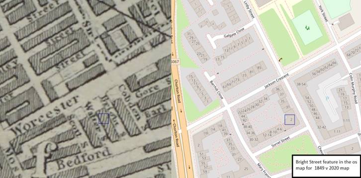
Bright St. Highlighted by the blue square in the 1849 OS map in
comparison to the current 2020 OS map along side the 1845 os map
LINK to the 1845 os map
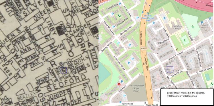
Bright St. Highlighted by the blue square in the 1960 OS map in
comparison to the current 2020 OS map along side the 1809 os map for te
area Bright st is below the arrow, Crown st top right.
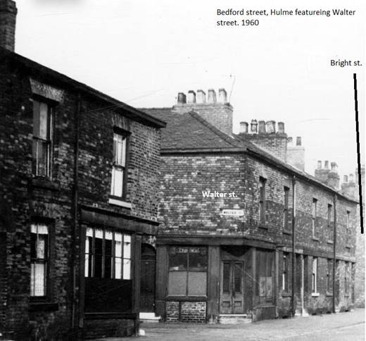
Walter St. being one street down from Bright
St.
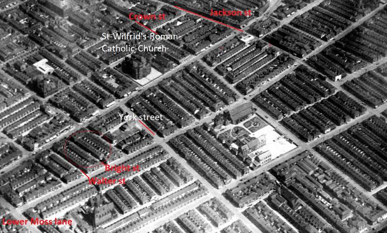
Aerial view of Hulme taken on the 9th June 1926